Fascinating water wealth of Dalmatian karsts
 Mentioning Dalmatia, everyone has a beautiful sea in mind and at the same time we forget that Dalmatia abounds in numerous freshwater areas: either rivers or lakes. The water in Dalmatia is not only salty, but also sweet and brackish. All Dalmatian rivers directly and indirectly affect the Adriatic Sea and thus belong to the Adriatic river basin district.
KRKA
The river Krka springs at the foot of the Dinara Mountain, 3.5 km northeast of Knin, beneath the 22-meter Topoljski Buk or Krčić, created by the tributary of the river Krčić. This is actually a unique example that one river (Krčić) ends with a waterfall, and another river (Krka) springs below the waterfall. Krčić dries up in summer. It flows into the Adriatic Sea near Šibenik. The total length of the river, with the submerged part of the mouth, is 72.5 km, of which 49 km is a freshwater stream and 23.5 km is a brackish watercourse.
The Krka flows through the Knin and Kosovo valleys where it receives the first significant tributaries: Butižnica, Orašnica, Kosovčica, Krčić, Radljevc and Marčinkovac, a total of 7 Knin rivers. At the exit from the field, it enters the canyon. The most famous tributary is the Čikola, which flows between Miljevci and Skradinski buk and forms a picturesque confluence with the Krka. Town of Knin, where Krka river springs, lays on 7 rivers. Apart of Krka we have: Krčić, Orašnica, Butižnica, Radljevac, Kosovčica and Marčinkovac. There are 7 waterfalls on the river Krka. Bilušića buk (22.3 m high) is located 16 km downstream from the spring. It is special precisely because it is the only waterfall that is not used for hydropower.
Brljan Waterfall (15.5 m) located 19 km downstream from the spring. The water of this waterfall and the water of Lake Bjelobera or Ćorića Lake are used in the hydroelectric power plant Miljacka.


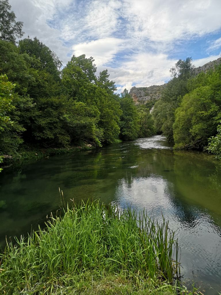
Manojlovac, like many waterfalls, consists of a series of travertine barriers. Manojlovac is the highest waterfall (59.6 m) with a main waterfall 32.2 m high. The water of this waterfall is used for hydropower in the Miljacka hydroelectric power plant. The Krka River from Knin to Skradin has been declared a National Park with surface of 111 square km. Regardless of the status of the national park, the river water is used for hydropower plants too. The remaining 4 waterfalls are Rošnjak (8.4m), Miljacka (23.8m), Roški slap (25.5m) and the most famous Skradinski buk (45.7m). On the river there is also Visovac Lake where the islet of Visovac with the Franciscan monastery is located. Downstream from Skradin, Krk spreads into Prokljansko Lake. It flows into the sea near Šibenik.
Hydropower plants on the Krka are as follows: Jaruga, Miljacka, Golubić, Roški slap and Krčić. The Jaruga hydroelectric power plant is the second oldest hydroelectric power plant in the world and the first in Europe. It was built under the waterfall Skradinski buk. On August 28, 1895, just three days after the first hydroelectric plant at Niagara Falls, the first Croatian and one of the world's first electric power systems was put into operation- Hydro power plant "Krka" - Šibenik. In 1905 a much larger hydroelectric power plant Jaruga II was built.
CETINA
Cetina springs at an altitude of 385 m in the northwestern slopes of the Dinara near the village of Cetina. There are several springs, and the main one is a lake over a hundred meters deep. Above the spring, north of Vrlika, there is the Lord's Cave, famous for its prehistoric population. Near Vrlika, Peruča Lake begins, artificially created by a dam on the Cetina 25 km downstream. After the lake, the river passes through the karsts area and Sinjsko polje towards the town of Sinj. The Cetina leaves Sinjsko polje near the town of Trilj, enters the canyon and flows south. The banks in the canyon are closer and higher, and the river is deep and slow. Once upon a time, water flowed quickly and turned many mills, but the dams slowed it down. Near Šestanovac Cetina turns to the south, and then near Zadvarje it turns around the mountain Mosor to the west. It flows into the Adriatic Sea in Omiš.
The tributaries of the Cetina are Rumin, Kosinac and Ruda. Dragović and Dabar are also tributaries but were submerged by Lake Peruča. The main right tributary is the river Vojskova. Just before the confluence with the Cetina, Karakašica joins Vojskova. The Cetina basin has many smaller rivers and springs. Only in the wider area of the village of Hrvaca alone, there are more than 50 springs with a name. Hydropower plants on the Cetina - Peruča, Orlovac, Đale, Kraljevac and Zakučac produce significant amounts of electricity.
ČIKOLA
Čikola springs near Mirlović Polje in the area of Petrovo polje; it flows through the town of Drniš and flows into the river Krka downstream from Miljevci, above Skradinski buk. The riverbed is often dry because larger amounts of water at the source are used for the needs of the town of Drniš. The area next to the source of the Čikola River is strongly influenced by the continental climate. The lowest average air temperature at the Čikola estuary is around 7.7 °C, while the highest summer average air temperature is around 23.7 ° C.
ZRMNJA
The river Zrmanja flows through the northern part of Dalmatia. It springs up somewhere on the border with Lika with a spring at the foot of the Poštak mountain and flows in the Novigrad Sea, near Obrovac, from which it is navigable until it joins the sea. Its tributary Krupa is a beautiful river rich in numerous waterfalls up to ten meters high or deep. The flow of its liquid forced many millers to build water mills at the edges and in the shallows, trapping waves and rapids in wooden turbines that grind wheat and corn seeds, rye, oats or orzo into flour and corn flower.
Its main tributaries are Krnjeza and Krupa, and the Lika rivers Ričica and Otuća. It also receives water from a number of caves that complement its course, such as Čudina, Ðurica, Čavlinska, Milića and others. Zrmanja flows through Mokro polje (where it dries up in summer), then through Ervenik and Žegarsko polje. After the village of Žegar, a canyon up to 300 meters high dominates. There are numerous waterfalls and the most famous is Janković buk.


DALMATIAN LAKES
There are many Dalmatian lakes and the largest of them is Vrana Lake, the largest ornithological reserve in Dalmatia. Red Lake in the vicinity of Modro Lake is also a karts’ pit filled with water and, judging by the depth of 287 meters, is the deepest lake in Europe. Peručko Lake is the largest accumulation lake in this area. Seven Baćina lakes are near Ploče, and not far from Opuzen is Lake Kuti. Babino Lake on Velebit, in the area of Paklenica, at an altitude of about 1600 meters, freezes at this altitude in winter. To the east of Knin are Šarena and Bunrumsko Lake and to the north is the artificial lake of the Golubić hydroelectric power plant. All these karsts waters in the immediate vicinity of the sea are important habitats for numerous animal species, birds, fish, crabs, frogs and reptiles. The flora on these waters is very rich and diverse. By human action or inaction, the balance of bio and ecosystems has long been disturbed. Fortunately, in recent years there has been a greater awareness of concern for the environment and thus for these water resources. However, greater responsibility is still needed by all of us because unfortunately there are irresponsible individuals (citizens and industry) who pollute water.
Many institutions contribute to the fight to preserve water, especially drinking water, but civil society organizations are at the forefront of carrying out numerous clean-up actions and informing the public about the importance of preserving the environment.
Therefore, the results of the AHME project will make a long-term contribution to the conservation of wetlands and all waters.
![]()
![]()
Kodni broj projekta: 2019-1-FR01-KA202-062930